Work

Projects built with intelligence.

A closer look at how we take a real business problem and turn it into working software.

Case study · Web platform

Agroteka.rs

Visit site

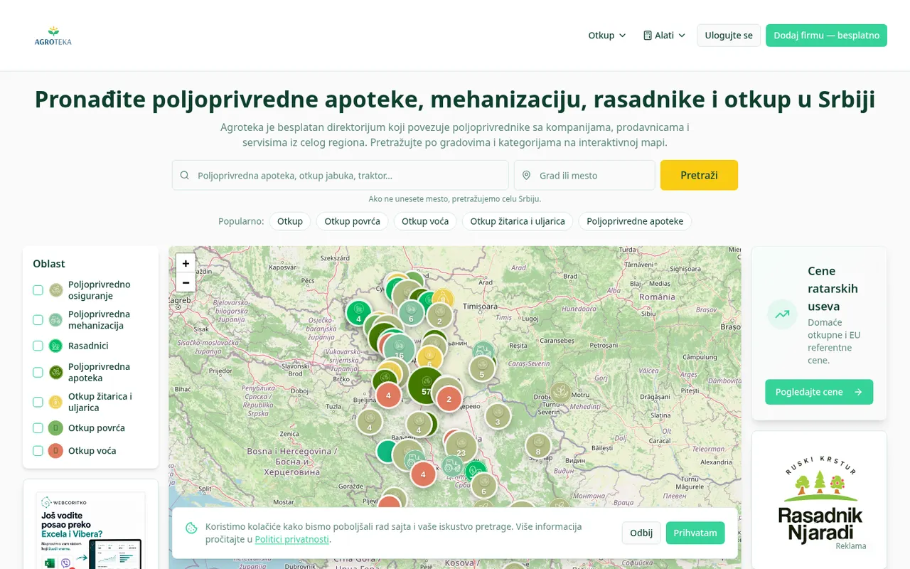
A free directory that connects farmers in Serbia with agricultural pharmacies, machinery dealers, nurseries, insurers and grain buy-up points — searchable by city and category on an interactive map, with live crop prices and weather on top.

ReactLeaflet / OpenStreetMapPostgresSEOAds

01 — Problem

A fragmented, non-transparent agricultural cluster

Farmers in Serbia had no single place to find agricultural pharmacies, machinery dealers, nurseries, insurance or grain buy-up points. Information lived in Facebook groups, phone calls and word of mouth. Buy-up prices were opaque, so growers could not tell whether an offer was fair, and small local businesses had no digital visibility at all.

  • No central catalogue of agri businesses per city or region
  • Crop buy-up prices unknown until you called around
  • Local shops and nurseries invisible online

02 — Plan

One free, map-first directory with real data behind it

The plan was a public directory that a farmer can use in under ten seconds — open the map, see what is nearby, filter by category, call. On top of the directory we planned two data layers that give people a reason to come back weekly: domestic and EU reference crop prices, and a regional weather forecast. Monetisation stays light: category-level ad slots for agri brands instead of a paywall.

  • Map-first UX, mobile before desktop
  • Five clear categories: pharmacies, machinery, nurseries, insurance, buy-up
  • Price + weather layers as the recurring reason to return
  • SEO landing page per category and per city

03 — Implementation

Built and shipped iteratively

A React front end with Leaflet and OpenStreetMap tiles renders thousands of geocoded locations without a paid maps bill. Data lives in Postgres with row-level security, images and category icons in object storage, and an admin flow lets new businesses be added or verified without a deploy. Crop prices and the Open-Meteo forecast are fetched and cached server-side, so pages stay fast. Consent banner, privacy policy and structured data were part of the first release, not an afterthought.

  • React + Leaflet / OpenStreetMap interactive map
  • Postgres + object storage, admin-managed listings
  • Cached server-side price and weather integrations
  • SEO: per-category routes, sitemap, structured data, GDPR consent

04 — Solution

A transparent agricultural hub — free for farmers

Agroteka.rs is live. A farmer opens one page, sees every relevant business around them on a map, checks today's buy-up prices and the forecast for their region, and calls the right company directly. Local businesses get discoverable profiles they never had, and agri brands get advertising space in exactly the category they sell into.

  • Single entry point for the whole agri supply chain
  • Price transparency instead of phone-around guessing
  • Free for farmers, ad-supported for the platform
  • Scales to new categories and countries without a rebuild

What is inside

Interactive map

Geocoded businesses across Serbia on Leaflet + OpenStreetMap.

Structured catalogue

Five categories, city filters and admin-verified listings.

Crop prices

Domestic buy-up and EU reference prices in one view.

Weather layer

Regional forecast via Open-Meteo, cached server-side.

Mobile-first

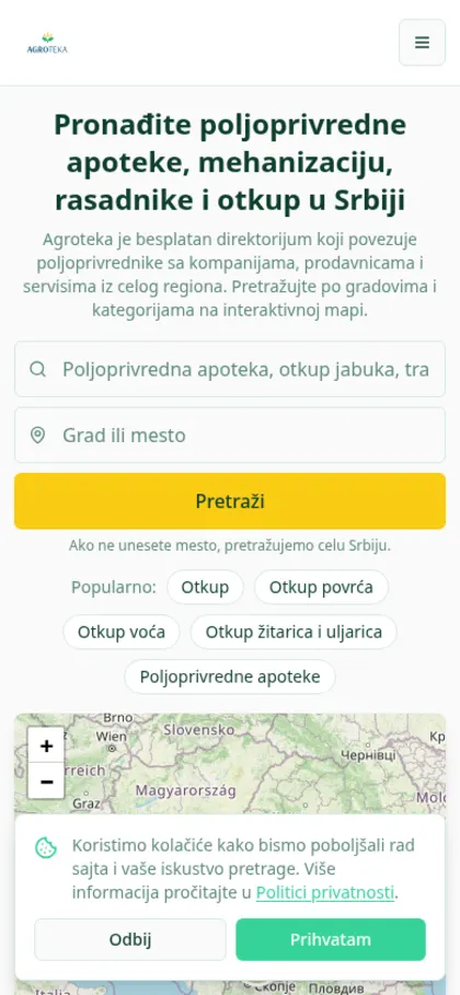
Designed for use in the field, on a phone, on weak signal.

Built for search

Category and city landing pages that rank organically.

Have a project in mind?

Tell us what you are building and we will take it from problem to production the same way.

Contact us